A dedicated group of VAR cavers have been working on “Cave Hill” for a couple of years in an extensive survey effort. All caves known to exist, several new caves have been found as the result of ridge walking, are being surveyed and plotted onto a single map. Caves include Grand Caverns, Fountain, and Madison among others. Many intriguing mysteries have presented themselves during the work. One of the outstanding mysteries is an underwater cave known as Steger’s Cave. The originally survey from November of 1980 resulted in a rough sketched map; the map generated more questions than answers.
Several scheduled dates had been planned, but fell through for various reasons. Brian Williams and Dave Duguid met at Grand Caverns on a perfect fall day on the 11th of November. The sun was shining and the temperature according to the forecast was to be in the 70’s. The intent was to get a handle on any riddle that Steger’s may hold. Bob and Jim were to assist with surface support.
Steger’s entrance is a Karst window near the base of Cave Hill. The window is a vertical fissure approximately five feet long and two feet wide; from the window to the water level is approximately 10 feet. Less than 25 feet from the cave is a river that happened to be running high and slightly milky.
After installing an aluminum ladder, a loose plan was put into place. The first step was to verify the correctness of the previous map and look for any additional passage not on the map. The second step in the plan, well that would be worked out after the completion of the first step.
I suited up, worked myself down to the water column, rigged my dive configuration as the individual components were lowered down, and submerged with a time limit of 30 minutes.
Dropping down the fissure it immediately became clear the cave was not well represented in the map. The 80-foot visibility enabled for a very good view of what lay ahead. The fissure cracks are more narrower, deeper, and more pronounced. I continued my descent and observed that the left wall consisted of a crusty clay substance that flaked off. Particles from percolation ranged from clay to small chunks of debris. The larger pieces were a bit unnerving as they rained down; I could feel them hitting my legs. The right wall was solid, though it did have large thin blades that with a little effort could be pulled off.
Following the pre-existing line, though not using it, I descended all the way to the bottom. At the bottom there was a six-foot karst window on the left leading to another vertical fissure. The two fissures were completely traversed at the bottom looking for additional passage. The only additional passage was a window the size of a softball. There were many isopods to be found swimming around.
Retreating along the line in a rainstorm of debris and rapidly falling visibility several short “jumps” off the line were made to insure there was no other passage at a shallower depth that was missing while descending. 28 minutes after the dive started I breached the surface.
After getting all equipment and myself out of the cave I updated all on my findings and drew a simple map. The second part of the plan was established; Brian would make a dive to gather the survey data and to take a few pictures. We waited over an hour before Brian geared up and descended into the cave. 30 minutes later Brian surfaced.
Brian’s first statement was the visibility did not clear up despite waiting. It would probably take days for the cloud to settle. Brian continued to describe his actions; he retraced much of my path through the cave with a few extra minutes spent at shallower depths hoping to find a new lead.
Both Brian and myself were satisfied, though disappointed, there was no more cave to be explored; and that we had sufficient data to generate a map that is a more accurate rendition of the cave.
Being that it was still early, we drove over to Madison cave. Madison is rarely open as it has historical significance as well as endangered isopods. The cave was open today as part of a resurvey effort. Jim provided us with a very thorough tour of Madison.
I found out that Madison was a commercial cave in the late 1700’s and early 1800s. The soot from the torches used remains present in the cave, thus giving the cave a dark appearance. Stopping to see George Washington’s signature in the cave was an unexpected bonus. The tour ended at the back of the cave where two sumps are present. The water clarity and surrounding cave looks very much like Steger’s.
The dive profile was as follows:
32% nitrox mix
89ft for 28min
Estimated distance of 200ft covered
No deco required, five minute safety stop done
Monday, November 13, 2006

Monday, November 06, 2006
Florida Cave Diving Trip
Joe and I had been through too long of a period for cave diving in Florida. Joe has since completed his move into his new house and my job move has settled down therefore the making of a road trip was in the works. We worked the pros and cons of both early and late departures out of Raleigh; it really boiled down to leaving a 4:30am to get a dive in that afternoon, or leave a 9am and sleep in. The need for rest won out. The trip to Florida was uneventful as usual, and long has usual. Though not pushing the afternoon dive schedule make the time a bit more relaxing.
We stopped at Bill Rennaker’s for fills rather than waste precious time in the morning. Bill was in good spirits despite business being a little slow. He stated the water levels are down, caves are generally clear, but people were not coming in from out of town. I wonder if the price of gasoline is simply forcing people to reconsider long trips, in a round about way it has affected Joe and my attitude toward making the trek to Florida.
Peacock Springs State Park
We stopped at Bill Rennaker’s for fills rather than waste precious time in the morning. Bill was in good spirits despite business being a little slow. He stated the water levels are down, caves are generally clear, but people were not coming in from out of town. I wonder if the price of gasoline is simply forcing people to reconsider long trips, in a round about way it has affected Joe and my attitude toward making the trek to Florida.
Peacock Springs State Park
Holding true to our tradition, we chose Peacock as our starting point. We have State park passes that are close to expiring; it was time to recover the initial cost of the pass. Besides Peacock has a lot of nice cave. It had been nine months since our last cave diving trip. Peacock is a more forgiving cave as it has several sinkholes that can be used as exits if needed.
The water level was indeed low; for those that know Peacock all the steps were out of the water. Due to the low water Peacock I had become a sink, the run that is typically present to the river was dried up. The lack of surface movement allowed for a large buildup of grass, weeds, and other delaying plant life to stink up the water.
Our plan was to take the Olson sink run, then proceed directly to Challenge sink. Turn the dive there and proceed back through the peanut restriction passage. This plan was not aggressive on our gas management; this dive would only use a bit more than half our gas supply.
The water once inside the cave cleared up very nicely, it was a little worrisome looking at the cloudy water from the steps. There were areas within the cave system where the water clarity changes, but even in the worst spots the visibility was still far superior to anything I had been diving the last six months.
Much of the passage taken on this dive was big and open, ideal for checking buoyancy, trim, and equipment modifications. We each made of few equipment changes this summer and now they were being put to the test. I returned to using the aluminum butt plate, while Joe removed his (Joe did go back to using his plate before the weekend was over).
The dive went smoothly; the kinks worked out in the first 30 minutes made for a very enjoyable dive. To make it even better, we didn’t see a single diver or any indication that any divers had been in the water before us that day until we got to the cavern zone. Here a team was putting a primary line in despite the mainline coming out into the basin. The team was obviously a team in training.
The dive profile was as follows:
- 32% nitrox mix
- 61ft for 131min
- Estimated distance of 5000ft covered
- No deco required, five minute safety stop done
Our second dive of the day was also done in Peacock state park; done at the Orange Grove sink. We opted to take the distance tunnel this run; the distance tunnel is much smaller cave with a thick silt covered bottom. The cave walls are very much the same as the remainder of Peacock.
The distance tunnel requires a bit more finesse; the characteristics of the cave are such that a complete silt-out is possible with one or two misplaced fine kicks. Called the dive earlier than needed, we had a long dive this morning and didn’t want to subject myself to another long dive.
The dive profile was as follows:
- 32% nitrox mix
- 58ft for 86min
- Estimated distance of 3500ft covered
- No deco required, five minute safety stop done
Madison Blue
Joe and I had planned to dive Lafayette Blue Spring on Saturday morning; but after talking with Dave and Cynthia about how good the conditions were at Madison and that the spring is now stated owned where our state park passes apply, how could we not go check it out. I had not been to Madison in years; in fact the last time I was there was during my caving certification process. The run to the Godzilla room is a common circuit amongst divers and instructors for training purposes.
The basin was amazingly clear; the submerged platform was still there; the second entrance called the rabbit hole could easily be seen. The platform perched high above the water used by swimmers to jump in was still there as well. While no swimmer were there in the morning, though they sure came in droves later in the day.
As we were gearing up two other dive teams arrived. One team was going to the Godzilla room and the other was going to Martz sink. To avoid running into the teams we opted for a main line run. We were the first into the water, set a primary reel and ventured into the rabbit hole. The flow near the entrance was stronger than I remember it being, but then again I didn’t remember much about the system; not remembering resulted in it taking few minutes to find the main line tucked out of sight from cavern divers.
It quickly become evident that this was going to be a good dive. The visibility was stunning; the water clarity was unreal. The water was so clear it took on a blue hue. Running up the main line we passed quite a few jump lines and noted their locations against the map we referenced before getting into the water. The cave past the Godzilla room wasn’t anything I had imagined; it was far better!
We took our time swimming in; we didn’t quite reach thirds when we called the dive. The urge to continue forward was great, that will have to be for another dive. The trip out was leisurely. We observed the team that stated they were going to Martz sink had come and gone; there was some fine particulate matter in the water from their having been there. As we reached the Godzilla jump we observed saw the tail end of the other teams dive and the massive cloud of sediment trailing. They completely wiped out the Godzilla run for a couple of hours.
We left our primary reel in place knowing we were doing a second dive. Out in the basin the Godzilla team was thrashing about. Joe and I stayed clear while we cleared out decompression obligation. O2 was used to reduce our decompression time and increase our safety margin.
The dive profile was as follows:
- 32% nitrox mix
- 80ft for 95min
- Estimated distance of 4200ft covered
- Ten minute deco / safety stop done
During our surface interval we walked over to check out Martz sink as it can be used as an entrance point to cut out several hundred feet of swimming. Martz was impressive; it’s a small sinkhole that narrows down to a pool of water that is only a few feet in diameter. Looking into the water the sink drops straight down. While standing there we planned our second dive. We wanted to see what Martz looked like from underneath the surface.
Returning to the van we suited up and went diving; our first stop was Martz sink. It is easy to find; it’s actually labeled on the main line! Taking the jump we swam with the line until it took a sharp vertical direction. Looking up from a depth of 60ft we could see the small surface pool at the end of a nice vertical fissure probably two feet by 10 feet the entire length.
We proceed on plan into a small passage that leads behind Martz sink. Here the flow was practically non-existent and the silt began to get deep. We continued on for a bit, however the amount of silt that was percolating off the ceiling and from even gentle fin kicks was reducing the visibility. The run down the passage was called, no sense diving in low visibility conditions when there is plenty of cave were the visibility is great!
We worked our way be toward the cave entrance to start the third part of the dive; that was to dive to the Godzilla room. After insuring we had air we headed toward the Godzilla room. I can honestly say I didn’t remember the passage, but there was a line and we had plenty of gas left in our tanks. Even if we didn't find the Godzilla room we continue diving the line we were on. We did reach the Godzilla room, decorated with a large Godzilla action play figure. We completed the circuit, which naturally points out of the cave.
The dive profile was as follows:
- 32% nitrox mix
- 90ft for 90min
- Estimated distance of 4000ft covered
- Ten minute deco / safety stop done
Lafayette Blue Spring
Having missed Lafayette Blue on Saturday we decided to do the dive on Sunday. Bill Rennaker had suggested we dive the lower portion of the system. Typically we dive from Bill’s privately owned sink and dive upstream. Today’s dive was going to dive from the State park (pass is working out great this trip) up to Bill’s sink called Trap sink.
The state park was empty besides the park ranger; the park was very clean, well kept, and even had hot water showers. The only down side observed thus far was the long walk from the parking area to the spring.
After suiting up and insuring we had enough gap reels we started our dive. It took a few minutes to find the main line, as the cavern near the basin was very large. We dive into the cave and quickly reached the first sink. The sink was expected; the line not going through the sink was also expected. What was not expected was the size of the sink and the fact that the sink is only three feet deep and its flow is so strong that you cannot swim against it.
After getting through that sink we quickly encountered the next sink. And low and behold it was repeat of the previous sink. Knowing we had one more sink to go and our dive profile already consisted of numerous bounces we opted to call the dive. It appears Bill left a few key parts of the system out of his description. If we had known before hand was the conditions held for us we would have certainly chosen a different dive.
The dive profile was as follows:
- 32% nitrox mix
- 48ft for 58min
- Estimated distance of 2000ft covered
- Five minute safety stop done
Tuesday, October 17, 2006
Haynes Cave
While visiting family in West Virginia I had a few hours to take my two older boys caving while our youngest napped. Before we left, I provided my wife Sandy with our location, time we expected to be out, and what to do and who to call should she not hear from us by the prearranged time.
My older son, Dawson, was really anxious to go, my middle son, Dylan, was a bit more timid and wanted to go I think more out of not wanting to miss out on anything (see the cave report about Island Ford Cave). I opted for Haynes cave in Monroe County; it is close to Lewisburg and is a very easy cave to access and to actually cave.
The shortest and easiest way to get to the cave is to cut across a large pasture. The boys were not to keen to walk in the field with the cows. With the cow's quizative look, standing their ground, and the pure size my boys felt more comfortable walking along the outside of the fence.
Not sure how Dylan would adapt to the dark environment I brought my u/w cave light to brighten things up a bit. The light exposed every dark spot in the cave; as a side note I need to bring this light to some of the caves with larger rooms, as it penetrates into the void with ease. Haynes cave doesn’t have much climbing, and what is does is very simple to climb. Dawson was really into it; Dylan was holding his own very well, so well I stopped using my u/w light and switched to a headlamp.
The cave was a dry as I remember resulting in significant amounts of dust in the air just from walking through. It didn’t help that Dawson and Dylan found the fine dirt on the ground to be very soft and soothing to the touch; much of their idle time was spent picking up handfuls of dirt and playing with it. It wasn’t long before all their close were a light shade of brown; my only hope was it would brush off easily, otherwise I’m sure my wife would have a word or two with me.
Walking through the cave we talked about how water carved the cave passages at one time and talked about how old the cave was. It wasn’t long before the kids thought dinosaurs walked and lived in the cave. There isn’t many formations, but of the few found we talked about how water made them (I think that might have been a difficult thing for them to believe or fully understand). But they were quick to point of the graffiti, or hieroglyphs as my older son called them, in the cave; that they could relate to.
We stopped and signed the registry on the way in; they each signed their names proudly. Dawson and Dylan found the idea of a registry a bit puzzling at first; but quickly warmed to the idea was we spent some time looking through the past entrants to the cave and that the next people to sign the registry would know that we were there.
We found a few brown bats; Dawson was very excited, as he knows a lot about bats. But he had not seen a real bat, and certainly not a bat in its natural habitat. We were lucky to find one bat near eye level; keeping a courteous distance they could see how the bat was hanging from its feet. We also
We walked the upper level all the way back to the end; a few of the pits were interesting to get around. The boys wanted to use the wooden walkways that have been there for many of years; and they probably safely could use them given their lack of weight. However I chose not to chance it and made them walk around or crawl into and out of the shallow pits. As we retreated we checked out one side lead before heading into the lower level (not the level at the bottom of the pit).
We did find the “well” that is used to get to the lowest level of the cave. There is an old hand crank used to pull buckets of Saltpeter from the lower depths of the cave during the civil war days. The boys were fascinated with the concept and wanted to go get a bucket and rope to see it actually work.
Time past too quickly, and with both of the boys enjoying themselves we lost track of time, I really did not expect our tour to last as long as it had. We have to leave the cave as the time I told Sandy to call in a rescue team should she not hear from me was quickly approaching.
And yes the dusty clothes cleaned up very nicely!
My older son, Dawson, was really anxious to go, my middle son, Dylan, was a bit more timid and wanted to go I think more out of not wanting to miss out on anything (see the cave report about Island Ford Cave). I opted for Haynes cave in Monroe County; it is close to Lewisburg and is a very easy cave to access and to actually cave.
The shortest and easiest way to get to the cave is to cut across a large pasture. The boys were not to keen to walk in the field with the cows. With the cow's quizative look, standing their ground, and the pure size my boys felt more comfortable walking along the outside of the fence.
Not sure how Dylan would adapt to the dark environment I brought my u/w cave light to brighten things up a bit. The light exposed every dark spot in the cave; as a side note I need to bring this light to some of the caves with larger rooms, as it penetrates into the void with ease. Haynes cave doesn’t have much climbing, and what is does is very simple to climb. Dawson was really into it; Dylan was holding his own very well, so well I stopped using my u/w light and switched to a headlamp.
The cave was a dry as I remember resulting in significant amounts of dust in the air just from walking through. It didn’t help that Dawson and Dylan found the fine dirt on the ground to be very soft and soothing to the touch; much of their idle time was spent picking up handfuls of dirt and playing with it. It wasn’t long before all their close were a light shade of brown; my only hope was it would brush off easily, otherwise I’m sure my wife would have a word or two with me.
Walking through the cave we talked about how water carved the cave passages at one time and talked about how old the cave was. It wasn’t long before the kids thought dinosaurs walked and lived in the cave. There isn’t many formations, but of the few found we talked about how water made them (I think that might have been a difficult thing for them to believe or fully understand). But they were quick to point of the graffiti, or hieroglyphs as my older son called them, in the cave; that they could relate to.
We stopped and signed the registry on the way in; they each signed their names proudly. Dawson and Dylan found the idea of a registry a bit puzzling at first; but quickly warmed to the idea was we spent some time looking through the past entrants to the cave and that the next people to sign the registry would know that we were there.
We found a few brown bats; Dawson was very excited, as he knows a lot about bats. But he had not seen a real bat, and certainly not a bat in its natural habitat. We were lucky to find one bat near eye level; keeping a courteous distance they could see how the bat was hanging from its feet. We also
We walked the upper level all the way back to the end; a few of the pits were interesting to get around. The boys wanted to use the wooden walkways that have been there for many of years; and they probably safely could use them given their lack of weight. However I chose not to chance it and made them walk around or crawl into and out of the shallow pits. As we retreated we checked out one side lead before heading into the lower level (not the level at the bottom of the pit).
We did find the “well” that is used to get to the lowest level of the cave. There is an old hand crank used to pull buckets of Saltpeter from the lower depths of the cave during the civil war days. The boys were fascinated with the concept and wanted to go get a bucket and rope to see it actually work.
Time past too quickly, and with both of the boys enjoying themselves we lost track of time, I really did not expect our tour to last as long as it had. We have to leave the cave as the time I told Sandy to call in a rescue team should she not hear from me was quickly approaching.
And yes the dusty clothes cleaned up very nicely!
Sunday, October 15, 2006
Hancock Cave Photo Trip Oct 4, 2006

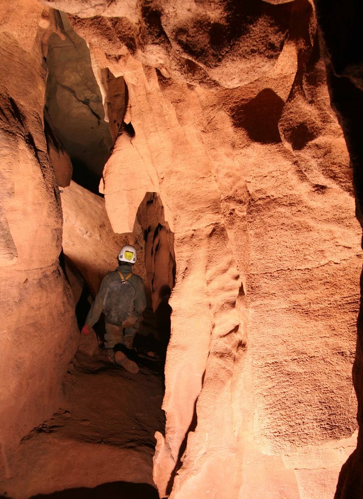
A gallant effort by Ken, Hayden, Howard, and Mike to help me take photos of some of the interesting features in Hancock Cave. Thanks again, Diana
(left) Hayden and Howard admire some solution pendants.
(below) Howard in the Octopus Room
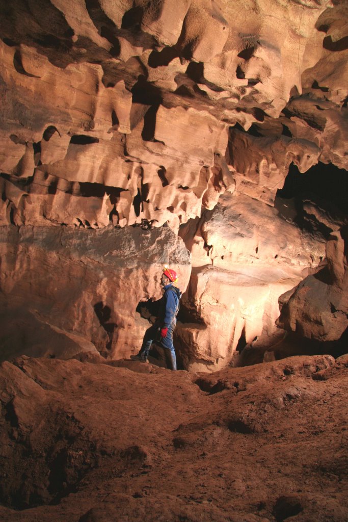

(left) Mike in passage near entrance.
(below) Hayden in small passage near vertical maze.
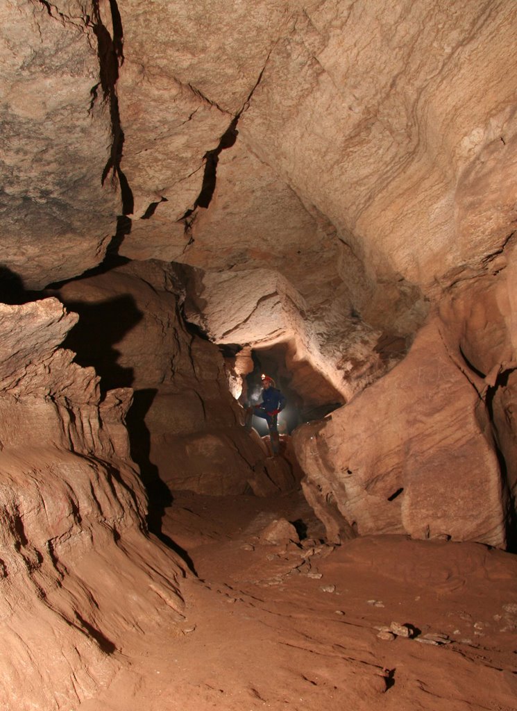
(left) Howard in some booming passage.
(below) Hayden with some solutional pendants.
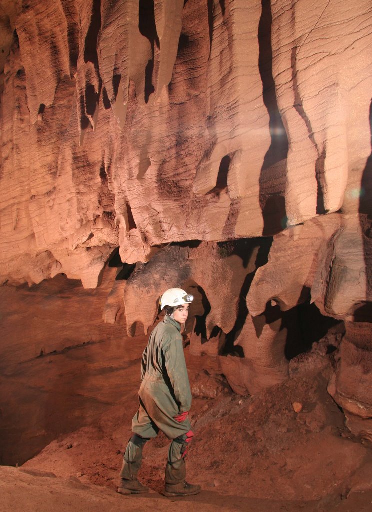

(left) Mike and Hayden. Cave passage that gives way to some interesting shadows and light.
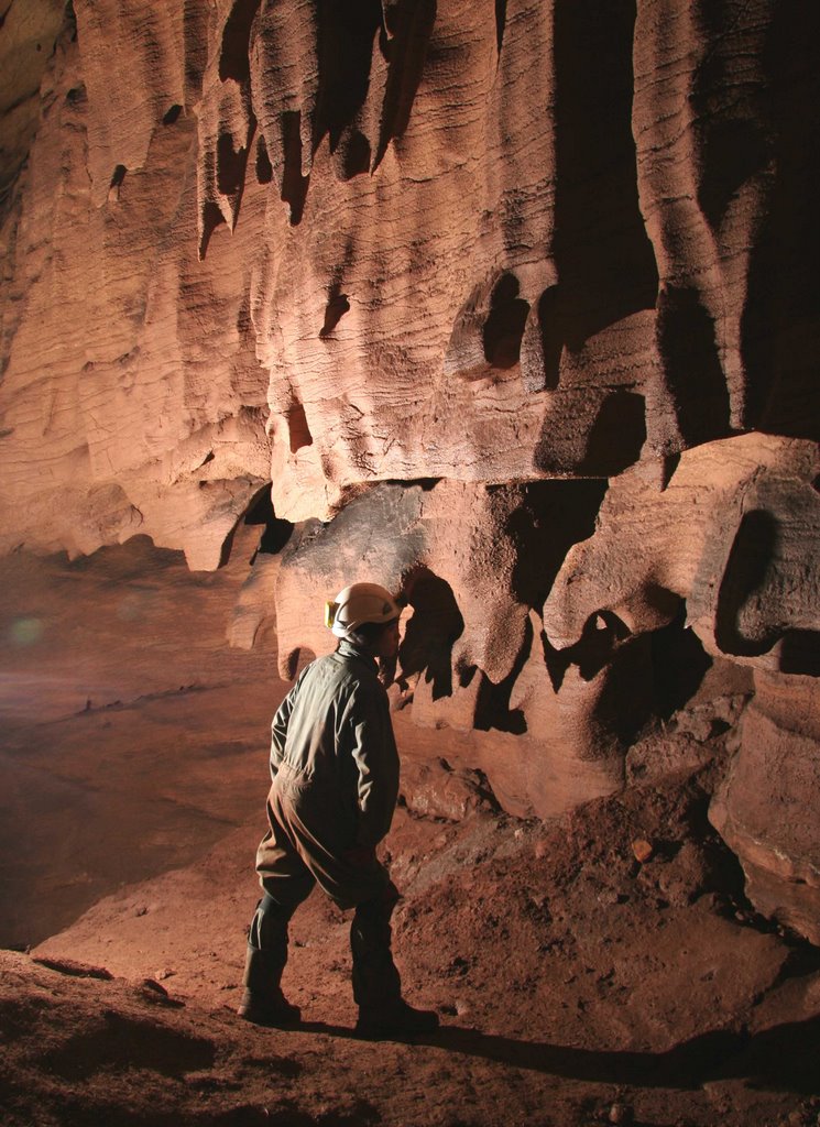
Photos by Diana G (2006)
Thursday, September 21, 2006
Rowland's Spring Cave
Not having been caving for quite some time I polled people for a survey trip the weekend of Sept 16 in the Marion VA area. In the end it was just myself from the greater Raleigh area. I spoke with Tanya regarding caving with only two people since three is the recommended minimum number of cavers. She was OK with two as long as we didn’t try to attempt more than we should. We tentatively agreed to cave at a cave called Rowland’s on Saturday and to head back to Wide Mouth to work on a dig or two on Sunday.
After a hardy breakfast we made way to Rowland’s cave. Rowland’s is not a recent discovery or a deep hidden secret, but it is on private property. We spoke to the owner for a short time, very nice gentleman. We spoke to him again after caving and showed him the rough sketch; he was very happy to see his cave come to life on a piece of paper.
My first impression driving back toward the hill the cave is in was one of questioning the cave size; the hill is actually very small. The owner told us there were two entrances, I couldn’t see how there could be much cave on the hill and have two entrances. At this point Tanya had found only one entrance due to the steep grade of the hillside.
We geared up and walked to the entrance and went inside the cave briefly to get a sense of which way the cave looked to be going. I was going to continue to work on my sketching abilities and needed all the advanced information I could think of for an educated guess as to where to put the first station on the page. Inside the cave there is an obvious southern passage and an obvious northern passage. The northern passage was an immediate climb down into a large, impressive canyon. The southern passage was a continuous downward sloping grade. We opted to focus on the southern passage; it would be easier to survey and sketch (a must for a novice).
As a two-person team we worked very well together; best of all, our numbers were working. The cave had a few areas that required a few splay shots so I could more accurately reflect the cave on paper. We found the cave getting deeper and deeper. This was an interesting observation; we were sure we were below the stream level of an active stream outside the cave. After finishing up what we could on the southern side we exited the cave to enjoy the beautiful late summer day. We left a possible dig or two that could lead to an active stream passage below; in fact there could be more than one tributary as the water appears to be coming from different directions.
While sitting around outside the cave snacking, I opted to climb the hill and try to find the other entrance. While climbing the hill on my hands and knees at times I found a small cave entrance. I was sure this was not the second entrance from the description the owner had provided, but something that could be checked out later. As I continued to look around I did find the other entrance, you cannot miss it; it is larger than the first entrance. The cave here was a large canyon, and was located within a logical path from the northern passage noted earlier. The cave here immediately slopes downward and then appears to go vertical. I say appears because I did not lean over the side due to the angle of the ground and amount of loose dirt and leaves where one would need to stand. I called to Tanya and she made her way up to the second entrance; she was equally impressed with the entrance.
After returning to the first entrance, our reformulated plan was to finish sketching the main room just inside the cave and then to check out the climb down on the northern passage. The climb down was not challenging; soon we were both in the streambed. The streambed source was from the underneath the southern passage we had just surveyed. Heading deeper into the cave we came to what would probably be a chimney climb with a long piece of nylon rope through the middle.
We kept to the plan and didn’t survey anymore, but rather exited the cave and discussed plans to get back in the cave. There is more survey here, some possible rope work, some possible high leads, and possible digs around the streambed. It is interesting to note that the stream is going into the hill and not out.
Due to my planned departure time on Sunday, we opted for a quick restaurant stop for breakfast, then quickly proceeded to Wide Mouth cave with tools in hand. We brought digging and chipping tools. After getting into the cave we chose to try and get through the narrow skeleton key hole first. We brought a mallet and chisel. Once at the restriction, the mallet was all that was needed. We shaved off about a two by five-inch sliver of rock and the restriction was passable. Note: The rock was not a formation and we felt the unnoticeable damage to the cave outweighed the amount of air blowing through.
Both Tanya and myself were able to get through the restriction and continued into the low passage. We trekked probably about 40ft before stopping. The passage continues, it is small and perhaps could be dug out a bit to increase the comfort level; but it is going and going. We can only hope it opens back up.
Given the time, we didn’t survey the passage, nor did we go check out the other dig I think I had broke through on a previous rip; but rather opted to check out the hillside a bit. There are a series of sinkholes in the ground and a few small potential cave entrances nearby. Again, it was interesting to realize that the passage we were in was lower than the streambed outside the cave. And that the streambed is currently dry, but a short distance upstream it is flowing.
Tanya nor myself have a date lined up to get back to Rowland’s, but we will be looking for volunteers to assist; the cave has a few more secrets to reveal. In addition there is ongoing work at Wide Mouth too!
The numbers for the survey:
24 Stations
259.2ft distance surveyed
49.1ft in depth
After a hardy breakfast we made way to Rowland’s cave. Rowland’s is not a recent discovery or a deep hidden secret, but it is on private property. We spoke to the owner for a short time, very nice gentleman. We spoke to him again after caving and showed him the rough sketch; he was very happy to see his cave come to life on a piece of paper.
My first impression driving back toward the hill the cave is in was one of questioning the cave size; the hill is actually very small. The owner told us there were two entrances, I couldn’t see how there could be much cave on the hill and have two entrances. At this point Tanya had found only one entrance due to the steep grade of the hillside.
We geared up and walked to the entrance and went inside the cave briefly to get a sense of which way the cave looked to be going. I was going to continue to work on my sketching abilities and needed all the advanced information I could think of for an educated guess as to where to put the first station on the page. Inside the cave there is an obvious southern passage and an obvious northern passage. The northern passage was an immediate climb down into a large, impressive canyon. The southern passage was a continuous downward sloping grade. We opted to focus on the southern passage; it would be easier to survey and sketch (a must for a novice).
As a two-person team we worked very well together; best of all, our numbers were working. The cave had a few areas that required a few splay shots so I could more accurately reflect the cave on paper. We found the cave getting deeper and deeper. This was an interesting observation; we were sure we were below the stream level of an active stream outside the cave. After finishing up what we could on the southern side we exited the cave to enjoy the beautiful late summer day. We left a possible dig or two that could lead to an active stream passage below; in fact there could be more than one tributary as the water appears to be coming from different directions.
While sitting around outside the cave snacking, I opted to climb the hill and try to find the other entrance. While climbing the hill on my hands and knees at times I found a small cave entrance. I was sure this was not the second entrance from the description the owner had provided, but something that could be checked out later. As I continued to look around I did find the other entrance, you cannot miss it; it is larger than the first entrance. The cave here was a large canyon, and was located within a logical path from the northern passage noted earlier. The cave here immediately slopes downward and then appears to go vertical. I say appears because I did not lean over the side due to the angle of the ground and amount of loose dirt and leaves where one would need to stand. I called to Tanya and she made her way up to the second entrance; she was equally impressed with the entrance.
After returning to the first entrance, our reformulated plan was to finish sketching the main room just inside the cave and then to check out the climb down on the northern passage. The climb down was not challenging; soon we were both in the streambed. The streambed source was from the underneath the southern passage we had just surveyed. Heading deeper into the cave we came to what would probably be a chimney climb with a long piece of nylon rope through the middle.
We kept to the plan and didn’t survey anymore, but rather exited the cave and discussed plans to get back in the cave. There is more survey here, some possible rope work, some possible high leads, and possible digs around the streambed. It is interesting to note that the stream is going into the hill and not out.
Due to my planned departure time on Sunday, we opted for a quick restaurant stop for breakfast, then quickly proceeded to Wide Mouth cave with tools in hand. We brought digging and chipping tools. After getting into the cave we chose to try and get through the narrow skeleton key hole first. We brought a mallet and chisel. Once at the restriction, the mallet was all that was needed. We shaved off about a two by five-inch sliver of rock and the restriction was passable. Note: The rock was not a formation and we felt the unnoticeable damage to the cave outweighed the amount of air blowing through.
Both Tanya and myself were able to get through the restriction and continued into the low passage. We trekked probably about 40ft before stopping. The passage continues, it is small and perhaps could be dug out a bit to increase the comfort level; but it is going and going. We can only hope it opens back up.
Given the time, we didn’t survey the passage, nor did we go check out the other dig I think I had broke through on a previous rip; but rather opted to check out the hillside a bit. There are a series of sinkholes in the ground and a few small potential cave entrances nearby. Again, it was interesting to realize that the passage we were in was lower than the streambed outside the cave. And that the streambed is currently dry, but a short distance upstream it is flowing.
Tanya nor myself have a date lined up to get back to Rowland’s, but we will be looking for volunteers to assist; the cave has a few more secrets to reveal. In addition there is ongoing work at Wide Mouth too!
The numbers for the survey:
24 Stations
259.2ft distance surveyed
49.1ft in depth
Tuesday, September 05, 2006
OTR 2006

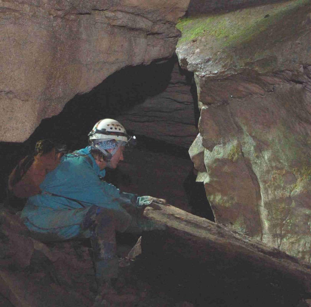
In an effort to avoid Hurricane Ernesto, Matt Jenkins, Anne Kehs, and I left the Triangle Thursday morning. We drove in the rain to OTR but set up camp during a dry spell.
I headed off to Dreen Cave on Friday morning to take my digital SLR camera on its first trip underground. Ericka Hoffmann and I played around with our cameras while the others rigged and dropped the nearby pit. My photos can be seen at http://mattcj.dyndns.org/~tritrogs/gallery/v/dreencave/. They're not great photos, but I really liked being able to use the remote to take the photo while I posed.
Saturday I spent cheering on TriTrogs and friends at the Speleolympic Events (http://mattcj.dyndns.org/~tritrogs/gallery/v/otr2006/).
Sunday found me back at Cassell Cave. I went with Bob Hoke and Katherine Bertaut down to the Mud Maze. We all got thoroughly slimed surveying in the sticky mud, but our boots were cleaned again in the stream. We got out of the cave around 9:30 PM and went back to OTR for a fast food dinner and campfire singing with Baltimore Grotto.
Sunday, August 13, 2006
Trip Around the Block
Destination: Hancock Cave
Date: August 12, 2006
Participants: Anne Kehs, Mark Little, Ken Walsh, and our hosts and friends (Dave, Drew, John, and Craig)
Have you ever visited a cave so many times that you know the moves like the back of your hand? And then you drag others through it at a comfortable pace until you bring tears to their eyes? Neither do I. At least not quite.
The new landowner at Hancock Cave, Dave, had asked that the TriTrogs give his grandson and him a short tour of the cave. We planned it for the weekend when Dave’s thirteen-year-old grandson was in from California, and I warned him that Hancock is truly a caver’s cave, not for sissies in shiny clean Spandex.
To accommodate a Kenny Chesney concert ticketholder, Anne, Mark, and I drove through a rainstorm to the cave Saturday morning, and everyone met up at the appointed time. At the cave entrance, I gave a short lecture about caving safety and conservation. Everyone listened attentively while I spoke and then taught them how to climb a cable ladder.
No problems descending into the cave, and I (in front) heard no problems as they ascended the first 10-foot climb. I spotted folks as they came down the etrier drop, and no one seemed out of sorts yet.
We sped along to the Octopus Room as everyone enjoyed the shape of the trunk passage (until it became a crawlway). Dave pulled out his copy of the draft map and oriented everyone to the map. We took a short detour over to the Whine Cellar and the first of the dry Toilet Bowls. This was a good warmup for everyone to get their caving legs. As we moved down the passage, I kept getting asked what the name of each object in the cave was. When they found out that a lot of the cave is unnamed, they took it upon themselves to name formations and passages. GREAT!
From the Octopus Room, I started a tour of the pendants and led them toward the back entrance. They asked about the passage name where we walk among the pendants, and I just responded “In the Pendants Hall.” That really got them going. The high window above the stream is now called Rapunzel’s Tower, and the flaked flowstone mound just beyond is now known as The Spinnaker. We played around in the crawlways that lead toward the Long Room, we taught a little bit about chimneying and a lot about butt friction, and everyone still had some energy.
I picked a bad place for seven people to sit for lunch, a room that Dave noted has a breakdown piece shaped like Iceland. Therefore, I led them straight up a climb into the Anastamoses Maze.I probably should’ve picked an easier route, especially as I watched Anne’s kneepads slide down to her ankles. Lunch was what everyone needed to be refreshed after the climb.
After that I dragged the beginners down the Corn Cob Crawl, and Craig felt the joy of wearing his skivvies as a thong. Over toward Hickory Dickory Pit the men worked on lowering their voices to echo “Doom” while Anne and Drew tossed mud patties from Anne’s boots into the pit.
Drew is a great natural caver (better than Hayden when he began), but I denied him a trip up to retrieve Dave Duguid’s webbing from our June trip. I trust Melanie’s balance and timing a little bit more than someone I just met that day for a novice trip. It was probably time to start heading out anyway.
I saved the descent down the Breakdown Staircase for last, and I was very impressed by how well they had learned that day. John had been the person who kept saying that he felt lost in every room, but he did a great job coaching Anne down the steps in the Breakdown Staircase. Anne coached the rest, and they trusted her implicitly.
We followed the canyon straight back into Harrington Hall. I told everyone that they had been there a few times already that day, and Drew immediately knew the way back to the Octopus Room. After I slowed people up to photograph the etrier climb, a salamander slowed up the photographers near the entrance. We made a fun five-hour trip out of the adventure and managed to return everyone to the surface.
Date: August 12, 2006
Participants: Anne Kehs, Mark Little, Ken Walsh, and our hosts and friends (Dave, Drew, John, and Craig)
Have you ever visited a cave so many times that you know the moves like the back of your hand? And then you drag others through it at a comfortable pace until you bring tears to their eyes? Neither do I. At least not quite.
The new landowner at Hancock Cave, Dave, had asked that the TriTrogs give his grandson and him a short tour of the cave. We planned it for the weekend when Dave’s thirteen-year-old grandson was in from California, and I warned him that Hancock is truly a caver’s cave, not for sissies in shiny clean Spandex.
To accommodate a Kenny Chesney concert ticketholder, Anne, Mark, and I drove through a rainstorm to the cave Saturday morning, and everyone met up at the appointed time. At the cave entrance, I gave a short lecture about caving safety and conservation. Everyone listened attentively while I spoke and then taught them how to climb a cable ladder.
No problems descending into the cave, and I (in front) heard no problems as they ascended the first 10-foot climb. I spotted folks as they came down the etrier drop, and no one seemed out of sorts yet.
We sped along to the Octopus Room as everyone enjoyed the shape of the trunk passage (until it became a crawlway). Dave pulled out his copy of the draft map and oriented everyone to the map. We took a short detour over to the Whine Cellar and the first of the dry Toilet Bowls. This was a good warmup for everyone to get their caving legs. As we moved down the passage, I kept getting asked what the name of each object in the cave was. When they found out that a lot of the cave is unnamed, they took it upon themselves to name formations and passages. GREAT!
From the Octopus Room, I started a tour of the pendants and led them toward the back entrance. They asked about the passage name where we walk among the pendants, and I just responded “In the Pendants Hall.” That really got them going. The high window above the stream is now called Rapunzel’s Tower, and the flaked flowstone mound just beyond is now known as The Spinnaker. We played around in the crawlways that lead toward the Long Room, we taught a little bit about chimneying and a lot about butt friction, and everyone still had some energy.
I picked a bad place for seven people to sit for lunch, a room that Dave noted has a breakdown piece shaped like Iceland. Therefore, I led them straight up a climb into the Anastamoses Maze.I probably should’ve picked an easier route, especially as I watched Anne’s kneepads slide down to her ankles. Lunch was what everyone needed to be refreshed after the climb.
After that I dragged the beginners down the Corn Cob Crawl, and Craig felt the joy of wearing his skivvies as a thong. Over toward Hickory Dickory Pit the men worked on lowering their voices to echo “Doom” while Anne and Drew tossed mud patties from Anne’s boots into the pit.
Drew is a great natural caver (better than Hayden when he began), but I denied him a trip up to retrieve Dave Duguid’s webbing from our June trip. I trust Melanie’s balance and timing a little bit more than someone I just met that day for a novice trip. It was probably time to start heading out anyway.
I saved the descent down the Breakdown Staircase for last, and I was very impressed by how well they had learned that day. John had been the person who kept saying that he felt lost in every room, but he did a great job coaching Anne down the steps in the Breakdown Staircase. Anne coached the rest, and they trusted her implicitly.
We followed the canyon straight back into Harrington Hall. I told everyone that they had been there a few times already that day, and Drew immediately knew the way back to the Octopus Room. After I slowed people up to photograph the etrier climb, a salamander slowed up the photographers near the entrance. We made a fun five-hour trip out of the adventure and managed to return everyone to the surface.
Subscribe to:
Posts (Atom)