Not having been caving for quite some time I polled people for a survey trip the weekend of Sept 16 in the Marion VA area. In the end it was just myself from the greater Raleigh area. I spoke with Tanya regarding caving with only two people since three is the recommended minimum number of cavers. She was OK with two as long as we didn’t try to attempt more than we should. We tentatively agreed to cave at a cave called Rowland’s on Saturday and to head back to Wide Mouth to work on a dig or two on Sunday.
After a hardy breakfast we made way to Rowland’s cave. Rowland’s is not a recent discovery or a deep hidden secret, but it is on private property. We spoke to the owner for a short time, very nice gentleman. We spoke to him again after caving and showed him the rough sketch; he was very happy to see his cave come to life on a piece of paper.
My first impression driving back toward the hill the cave is in was one of questioning the cave size; the hill is actually very small. The owner told us there were two entrances, I couldn’t see how there could be much cave on the hill and have two entrances. At this point Tanya had found only one entrance due to the steep grade of the hillside.
We geared up and walked to the entrance and went inside the cave briefly to get a sense of which way the cave looked to be going. I was going to continue to work on my sketching abilities and needed all the advanced information I could think of for an educated guess as to where to put the first station on the page. Inside the cave there is an obvious southern passage and an obvious northern passage. The northern passage was an immediate climb down into a large, impressive canyon. The southern passage was a continuous downward sloping grade. We opted to focus on the southern passage; it would be easier to survey and sketch (a must for a novice).
As a two-person team we worked very well together; best of all, our numbers were working. The cave had a few areas that required a few splay shots so I could more accurately reflect the cave on paper. We found the cave getting deeper and deeper. This was an interesting observation; we were sure we were below the stream level of an active stream outside the cave. After finishing up what we could on the southern side we exited the cave to enjoy the beautiful late summer day. We left a possible dig or two that could lead to an active stream passage below; in fact there could be more than one tributary as the water appears to be coming from different directions.
While sitting around outside the cave snacking, I opted to climb the hill and try to find the other entrance. While climbing the hill on my hands and knees at times I found a small cave entrance. I was sure this was not the second entrance from the description the owner had provided, but something that could be checked out later. As I continued to look around I did find the other entrance, you cannot miss it; it is larger than the first entrance. The cave here was a large canyon, and was located within a logical path from the northern passage noted earlier. The cave here immediately slopes downward and then appears to go vertical. I say appears because I did not lean over the side due to the angle of the ground and amount of loose dirt and leaves where one would need to stand. I called to Tanya and she made her way up to the second entrance; she was equally impressed with the entrance.
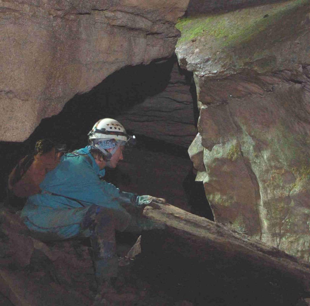
After returning to the first entrance, our reformulated plan was to finish sketching the main room just inside the cave and then to check out the climb down on the northern passage. The climb down was not challenging; soon we were both in the streambed. The streambed source was from the underneath the southern passage we had just surveyed. Heading deeper into the cave we came to what would probably be a chimney climb with a long piece of nylon rope through the middle.
We kept to the plan and didn’t survey anymore, but rather exited the cave and discussed plans to get back in the cave. There is more survey here, some possible rope work, some possible high leads, and possible digs around the streambed. It is interesting to note that the stream is going into the hill and not out.
Due to my planned departure time on Sunday, we opted for a quick restaurant stop for breakfast, then quickly proceeded to Wide Mouth cave with tools in hand. We brought digging and chipping tools. After getting into the cave we chose to try and get through the narrow skeleton key hole first. We brought a mallet and chisel. Once at the restriction, the mallet was all that was needed. We shaved off about a two by five-inch sliver of rock and the restriction was passable. Note: The rock was not a formation and we felt the unnoticeable damage to the cave outweighed the amount of air blowing through.
Both Tanya and myself were able to get through the restriction and continued into the low passage. We trekked probably about 40ft before stopping. The passage continues, it is small and perhaps could be dug out a bit to increase the comfort level; but it is going and going. We can only hope it opens back up.
Given the time, we didn’t survey the passage, nor did we go check out the other dig I think I had broke through on a previous rip; but rather opted to check out the hillside a bit. There are a series of sinkholes in the ground and a few small potential cave entrances nearby. Again, it was interesting to realize that the passage we were in was lower than the streambed outside the cave. And that the streambed is currently dry, but a short distance upstream it is flowing.
Tanya nor myself have a date lined up to get back to Rowland’s, but we will be looking for volunteers to assist; the cave has a few more secrets to reveal. In addition there is ongoing work at Wide Mouth too!
The numbers for the survey:
24 Stations
259.2ft distance surveyed
49.1ft in depth
Thursday, September 21, 2006
Tuesday, September 05, 2006
OTR 2006

In an effort to avoid Hurricane Ernesto, Matt Jenkins, Anne Kehs, and I left the Triangle Thursday morning. We drove in the rain to OTR but set up camp during a dry spell.
I headed off to Dreen Cave on Friday morning to take my digital SLR camera on its first trip underground. Ericka Hoffmann and I played around with our cameras while the others rigged and dropped the nearby pit. My photos can be seen at http://mattcj.dyndns.org/~tritrogs/gallery/v/dreencave/. They're not great photos, but I really liked being able to use the remote to take the photo while I posed.
Saturday I spent cheering on TriTrogs and friends at the Speleolympic Events (http://mattcj.dyndns.org/~tritrogs/gallery/v/otr2006/).
Sunday found me back at Cassell Cave. I went with Bob Hoke and Katherine Bertaut down to the Mud Maze. We all got thoroughly slimed surveying in the sticky mud, but our boots were cleaned again in the stream. We got out of the cave around 9:30 PM and went back to OTR for a fast food dinner and campfire singing with Baltimore Grotto.
Subscribe to:
Posts (Atom)